Salesforce Managed Package
Geo Regions
Bring your Salesforce data to life with interactive choropleth maps. Visualize accounts, revenue, and any record data across geographic boundaries — right inside Salesforce.
Key Features
Everything you need to visualize geographic data in Salesforce.
Interactive Choropleth Maps
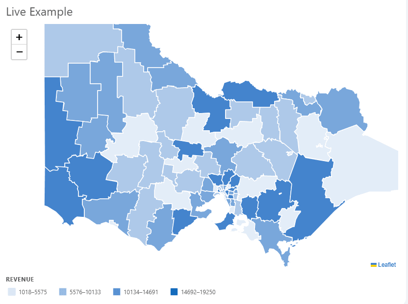
Regions shaded by your Salesforce data values with smooth color gradients and an interactive legend.
Dynamic Data Binding
Pass any Salesforce record array and bind fields to geographic boundaries — accounts, revenue, opportunities, and more.
Tooltips & Zoom
Hover for rich data tooltips. Click any region to zoom to its bounds and fire custom events for downstream logic.
Configurable Color Schemes
Choose your base color, number of shade buckets, and legend titles to match your org's branding.
Modular Architecture
Core engine ships separately from country data packages. Add new maps without modifying the engine.
Accessibility & Security
Keyboard-navigable legend, XSS-protected tooltips, and proper loading and error states out of the box.
See It in Action
Victorian Local Government Areas visualized by revenue data with interactive legend filtering.
Simple Pricing
Try the Australia extension free for 30 days, or get unlimited access for your whole org.
Australia Extension
30-Day Free Trial
Try the Australia extension with your team for 30 days before you commit.
- All Australian geographic boundaries
- Full feature access
- 30-day trial, no commitment
- Community support
Australia Extension
Unlimited
Site-wide license for the Australia extension across your entire Salesforce org.
- All Australian geographic boundaries
- Full feature access
- Unlimited user seats
- Org-wide site license
- Priority support
Ready to visualize your data?
Start your 30-day free trial of the Australia extension and begin visualizing your data.